
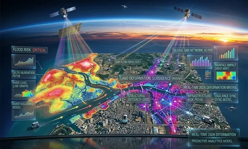
Synthetic Aperture Radar: Orbital Vigilance for Flood Risk and Land Deformation
In 2026, the global capacity for disaster resilience has been fundamentally transformed by the operational maturity of Synthetic Aperture Radar (SAR) constellations. Unlike traditional optical satellites that are blinded by the very storm clouds that cause disasters, SAR “sees” through atmospheric interference to provide high-resolution data in all weather conditions. By leveraging the unique dual-band capabilities of the NASA-ISRO SAR (NISAR) mission alongside the consistent archives of Sentinel-1, geospatial analysts can now map floods in real-time and detect millimeter-scale land deformations before they manifest as catastrophic failures.
The All-Weather Sentinel
The primary limitation of traditional Earth observation has always been its reliance on visible light. During a major hurricane or monsoon, optical sensors are rendered useless by cloud cover precisely when data is most needed. Synthetic Aperture Radar (SAR) overcomes this by being an active sensor; it emits its own microwave pulses and measures the “backscatter” that returns from … Read the rest