
As the international community enters the second Global Stocktake (GST) cycle in 2026, the reliance on self-reported national data is being supplemented by a “Top-Down” orbital audit. Essential Climate Variables (ECVs), defined by the Global Climate Observing System (GCOS), provide the objective, physical evidence required to verify Nationally Determined Contributions (NDCs). By transitioning from statistical estimates to satellite-verified observations, national governments can enhance the scientific defensibility of their climate inventories and ensure compliance with the Enhanced Transparency Framework (ETF) of the Paris Agreement.
The Transparency Imperative of 2026
The year 2026 marks a pivotal moment in global climate governance. Under the Paris Agreement’s Enhanced Transparency Framework, countries are now required to submit Biennial Transparency Reports (BTRs) that provide a clear, standardized account of their emissions and progress.
Essential Climate Variables (ECVs) are the critical metrics—spanning atmospheric, terrestrial, and oceanic domains—that characterize Earth’s climate. For national policy reporting, satellite-derived ECVs have moved from being “supplementary research data” to “foundational verification tools.” They provide an independent, global truth that helps resolve discrepancies between reported “bottom-up” inventories and the actual physical state of the atmosphere and biosphere.
The Atmospheric Layer: Verifying GHG Inventories
Traditionally, National Inventory Reports (NIRs) used “bottom-up” methods: calculating emissions by multiplying activity data (e.g., tons of coal burned) by emission factors. However, the 2026 reporting landscape now integrates “top-down” atmospheric verification using Greenhouse Gas (GHG) Concentration ECVs.
- Carbon Dioxide and Methane ($CO_2$ and $CH_4$): Missions such as GOSAT-GW and the Copernicus Sentinel-5P allow for the detection of methane super-emitters and the verification of national carbon budgets.
- The Inversion Model: By measuring concentrations in $ppm$ (parts per million) from orbit, scientists use atmospheric inversion models to calculate the net flux ($F_{net}$):
$$F_{net} = F_{anthro} + F_{nat}$$
Where $F_{anthro}$ is the anthropogenic emission and $F_{nat}$ is the natural flux from sinks like forests. This allows for a direct audit of a country’s claimed net emissions.
The Terrestrial Layer: Biomass and Land-Use Change
For many nations, the Land Use, Land-Use Change, and Forestry (LULUCF) sector is the most uncertain part of their report. Terrestrial ECVs provide a radical increase in accuracy for REDD+ and carbon sink accounting.
- Above-Ground Biomass: High-resolution missions like NASA’s GEDI (on the ISS) and the ESA’s BIOMASS mission provide 3D maps of forest structure. This allows countries to quantify exactly how much carbon is stored in their forests rather than relying on generalized lookup tables.
- Photosynthesis Metrics: ECVs such as FAPAR (Fraction of Absorbed Photosynthetically Active Radiation) and Leaf Area Index (LAI) are used to monitor the “health” and sequestering power of national sinks in real-time, providing proof that protected lands are actually performing as carbon sponges.
The Oceanic and Cryospheric Layers: Global Resilience Indicators
National policy isn’t just about mitigation; it’s about Adaptation and Loss and Damage.
- Sea-Level Rise and SST: Monitoring Sea-Surface Temperature (SST) and Sea-Level Rise (measured in $mm/year$) is vital for coastal nations. These ECVs provide the legal evidence needed for “Loss and Damage” fund applications by proving the direct link between global warming and local coastal erosion.
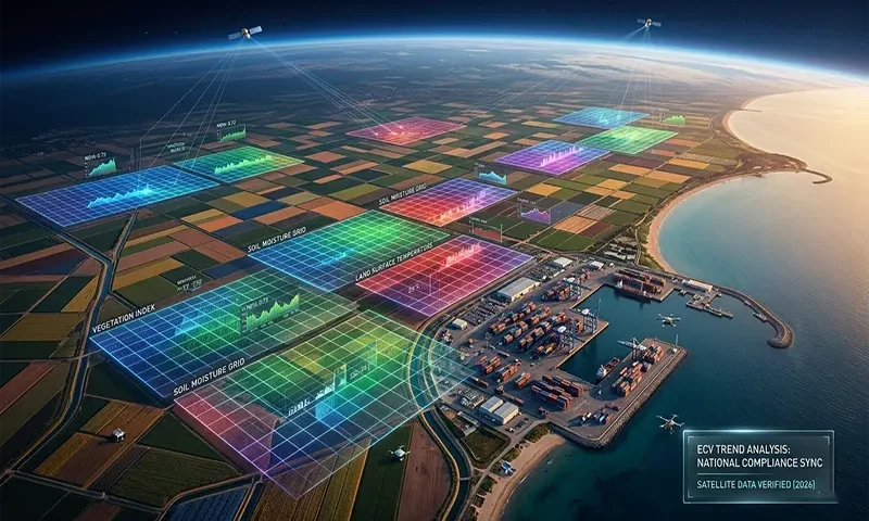
- Water Security: Satellite-derived Soil Moisture and Terrestrial Water Storage data are now integrated into national agricultural policies to predict drought and manage food security risks, allowing for “climate-smart” zoning and infrastructure planning.
Data Harmonization: The GCOS Climate Monitoring Principles
Following the updates at COP30, the GCOS Climate Monitoring Principles emphasize data continuity and traceability. For satellite data to be useful in policy, it must be:
- Traceable: Linked back to SI units.
- Stable: Providing a long-term record that isn’t disrupted by sensor changes.
- Peer-Reviewed: National compilers must be able to defend the satellite-derived figures in international technical expert reviews.
This “Pixel-to-Policy” pipeline ensures that when a country claims it has met its NDC, that claim is backed by a transparent, reproducible, and physical data trail.
Operational Challenges and Funding Sovereignty
Despite the benefits, two major challenges persist in 2026:
- The Continuity Gap: If funding for flagship programs like Copernicus or the Landsat series is not secured through the 2030s, the “climate record” will be broken, leaving policy-makers in the dark.
- Translation Capacity: Many Global South nations lack the domestic technical capacity to translate raw spectral data into the Common Reporting Tables (CRTs) required by the UNFCCC. International cooperation is shifting focus from “giving data” to “building the pipelines” for data interpretation.
Toward a Unified Climate Ledger
The integration of satellite-derived ECVs into national policy marks the end of the “best-guess” era of climate reporting. We are moving toward a unified global climate ledger—an objective, orbital audit of the Paris Agreement. By 2030, the discrepancy between what countries say they are doing and what the satellites see them doing will likely vanish, creating a new era of accountability that is essential for the survival of the global climate.
Satellite ECV Utility for National Reporting
| ECV Name | Primary Sensor/Platform | Policy Reporting Application |
| $CO_2$ & $CH_4$ Concentrations | GOSAT-GW / Sentinel-5P | NIR Verification / Methane Pledge |
| Above-Ground Biomass | GEDI / BIOMASS Mission | REDD+ / LULUCF Compliance |
| Sea-Level Rise | Sentinel-6 Michael Freilich | Loss & Damage / Adaptation Planning |
| Land Cover / Fire | Landsat-9 / MODIS / VIIRS | NDC Progress / Disaster Risk Reduction |
| Soil Moisture | SMAP / Sentinel-1 (SAR) | Agricultural Policy / Drought Relief |
| Ice Sheet Velocity | CryoSat-2 / NISAR | Global Tipping Point Monitoring |
